WFT™ – Water Finder Technology
Innovative and reliable to prospect for deposits of water technology
More than 30 years of research and work on electromagnetism allow us today to have a technology to prospect for water tanks.
The WFT™ is a technology, remote exploration based on the identification of electromagnetic interference caused by the same water tanks and through the spectral signature, called resonant frequency, in the deep blue range and the ultraviolet spectrum identifies the fluids within these anomalous areas
Stages of technology
Phase 1
SS – Satellital Spectroscopy
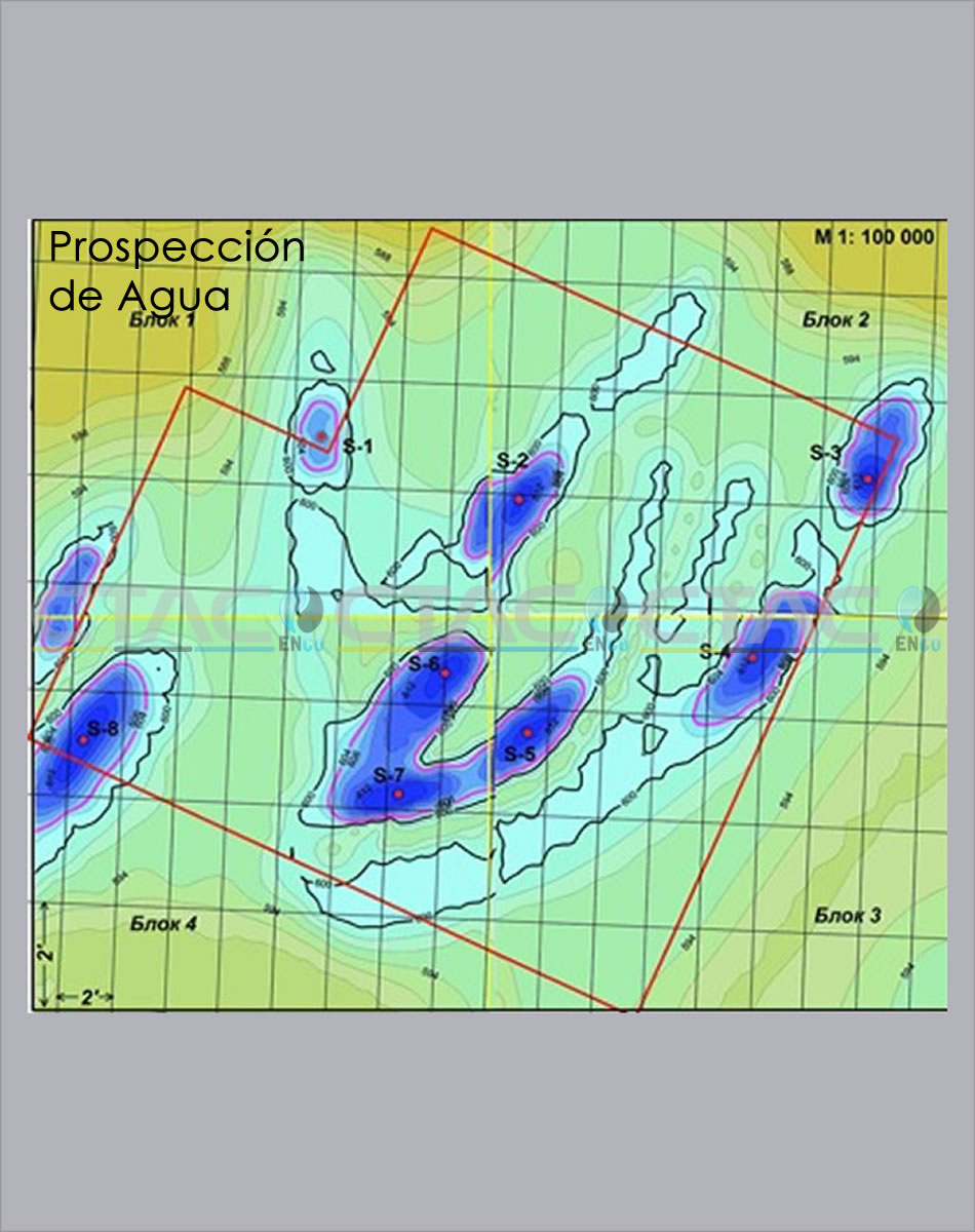
The search for water deposits in the areas of interest is done through the process of resonance frequency analysis (decoding) of remote sensing data (meta satellite datas) which allows to determine anomalies of the kind of water depot (DTA)

Phase 2
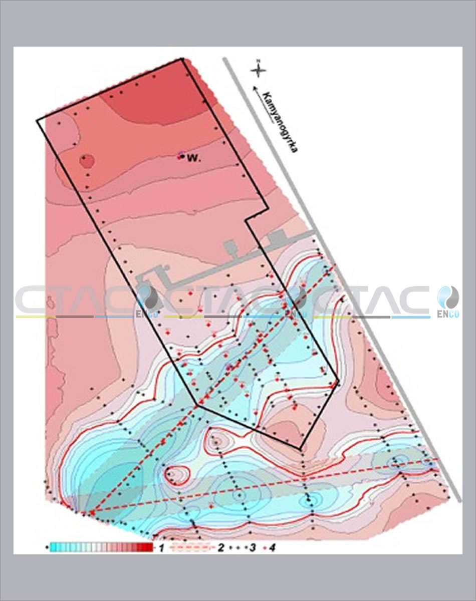
Geophysical method for mapping anomalies on the surface by excitation of the electromagnetic field in the anomalous zones which were detected in the first phase of spectrographs, with pulses at the resonance frequency of the water.

Applications of technology
EXPLORATION
EXPLORATORY AREAS: WFM™ is the starting point for the exploration of areas not previously studied. When performing the present spectroscopy leaflets are displayed in the area, discarding the areas where the presence of water is not evidence.
REINTERPRETING DATA: In areas where studies have already been conducted with the traditional tools, but there is uncertainty as to the areas for which the interpretation of data can be complicated, the WFT™ in these cases is of utmost help to elucidate the presence of water.
PRODUCTION
AQUIFER EXISTING: In the already developed aquifers, where reengineering is required to locate the areas of water accumulation that have not yet been located and also check for water in the structures are not known.
DRILLING
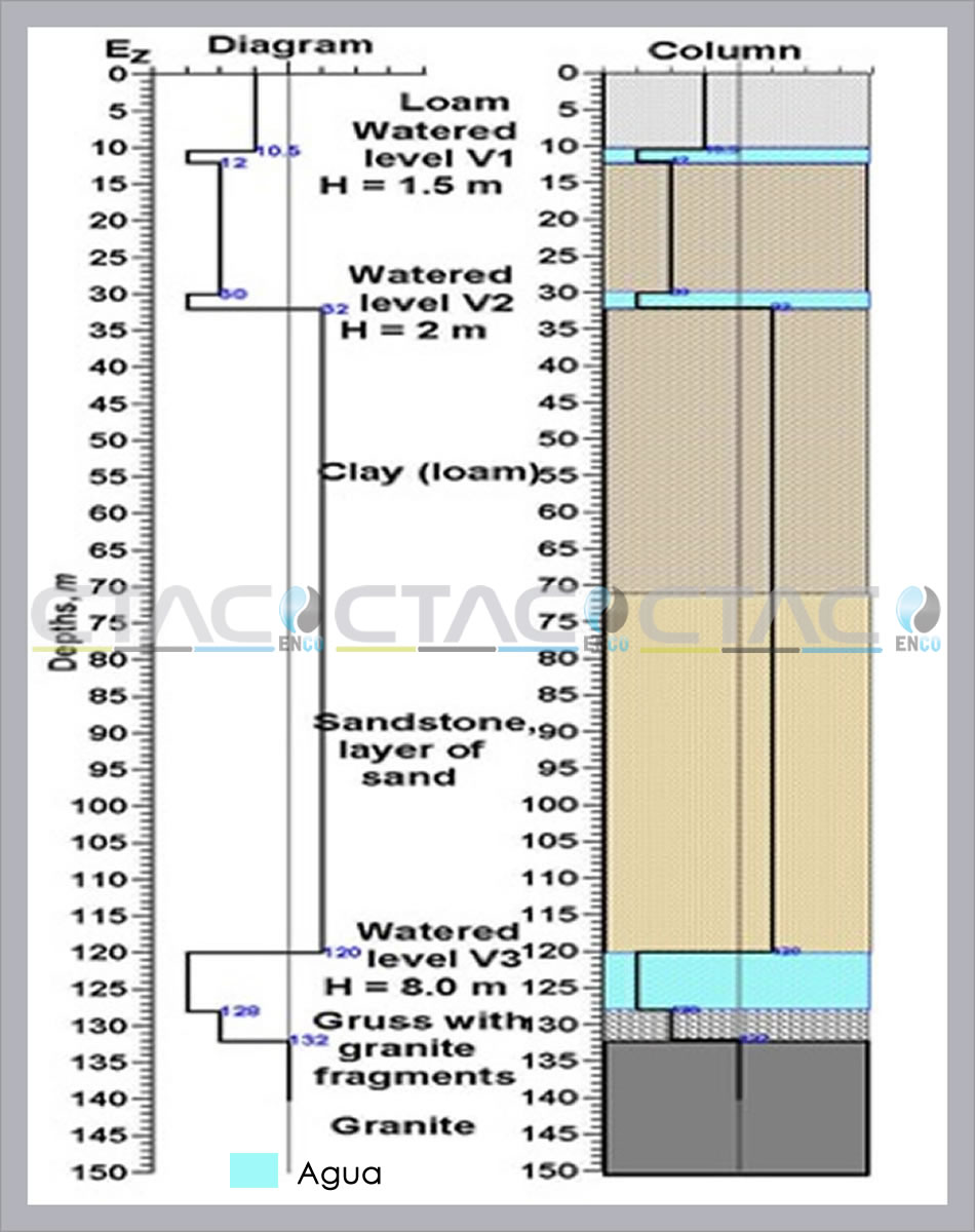
VIRTUAL DRILLING: A verification study will help forecast the WFT™ deposits present, its depths, thicknesses and approximate coordinates background where to direct drilling.
Why the WFM™?
- Ensures increased success in drilling campaigns.
- Considerable reduction of the time for information.
- Identification of groundwater due to salinity.
- Friendly to the environment and communities.
- It does not require permits and licenses.
- Lower costs to traditional methods.
- Remote exploration anywhere in the world.
- Ante verification coordinate drilling.

FAQ
WHAT IS A spectrography?
It is a graphical representation of electromagnetic anomalies that show the presence or absence of the material sought in the study area.
WHAT KIND OF SATELLITE IS USED FOR INFORMATION?
Dedicated to geophysical studies Georesurs-type P and DK satellites are used.
HOW THE ACQUISITION OF INFORMATION PERFORMED?
The acquisition is from passive platforms that acquire multispectral information specific study area.
WHAT INFORMATION IS OBTAINED THROUGH THE SATELLITE?
A metadata with multispectral information tied to the coordinates of the investigated area is obtained.
HOW IS THE INFORMATION PROCESSED?
In a laboratory of Geophysics satellite data it is transferred to a satellite plate in which the digital information is converted to analog, making it susceptible to be excited in a spectrometer and analyzed centimeter by centimeter.
HOW ACCURATE IS THE INFORMATION OBTAINED?
The information has a high degree of assertiveness, cataloged by 65% as an average, depending on the scale used.
IS IT NECESSARY FIELD WORK?
It is optional, depending on the technical task and the amount of information held in the study area.
HOW LONG RESULTS ARE DELIVERED?
For Phase 1, remote, between 15 and 30 days, depending on the scale and the area in question. For phases 2 and 3, the field, between 1 and 6 weeks to tour the area, depending on the topography and specific conditions of the area, after acquiring the data one month to deliver the final report.
WHAT IS THE FSPEF AND VERS?
Geophysical method FSPEF delimits the extent of the electromagnetic anomaly and the VERS surface and determines the depths, thicknesses and number of intervals of the polarized rock.
WHAT IS THE ENVIRONMENTAL IMPACT OF TECHNOLOGY?
It is void, does not require explosions, nor noise, there is no impairment to the flora and fauna or damage to property.
WHAT PERMITS OR LICENSES REQUIRED?
For the use of technology not require permits or licenses.


